Assessing multi‐temporal river‐floodplain dynamics as baseline for process‐oriented restoration in a large river: the Duero River, Spain
Authors: Díaz‐Redondo, M. ,Cortés, F. M., Molina, B. & Álvarez‐Rodríguez, J.
First published: 27 May 2021
Abstract
The time-based perspective of river-floodplain processes plays a key role in understanding its evolution until its present situation and in guiding process-based river restoration. However, despite the wide range of approaches to eco-hydromorphological characterization, the analysis of fluvial dynamics and their drivers under a temporal perspective requires more investigation.
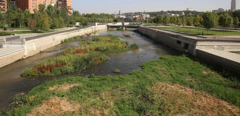
For the present study, a historical analysis of river-floodplain dynamics has been undertaken in a study section of the Duero River upstream of Zamora (Spain), within the framework of the DRAINAGE project for the integral management of flood risk. Aerial imagery for the period 1945–2017 was used to create habitat maps that were subsequently intersected to identify trajectories of habitat change (anthropization, changeless, progression, and regression).
In addition, a Natural Trajectory Index (NTI) and an Anthropization Ratio (AR) were proposed as a way to assess the balance of natural trajectories (progression vs. regression) and the weight of anthropization versus the sum of natural trajectories, respectively. Results show a system with a high degree of stability and anthropization, and a current imbalance of natural trajectories with a predominance of progression in the ecological succession. Rejuvenation processes have to be reactivated through nature-based solutions, allowing for more sustainable water management practices.
This perspective aims at promoting a more resilient system. The diachronic analysis presented is widely exportable to other river-floodplain systems as a basis for process-based restoration practice.


Implications for Practice
- Historical or diachronic studies can be successfully undertaken at the segment level to assess trajectories of change and current trends, and serve as a basis for process-based river restoration.
- Available historical cartography, such as old maps and aerial imagery, along with hydrological data, constitute the minimum base for the multi-temporal analysis of river-floodplain interactions.
- Trajectories of habitat change are observed as the result of hydromorphological and vegetation dynamics over time. Trends in trajectories of change have to be studied in relation to hydrology and hydromorphlogical pressures.
- Ratios comparing natural trajectories (progression and regression) and the predominance of anthropization are an easy and simple way to assess imbalances in past and current fluvial dynamics.
Website: https://onlinelibrary.wiley.com/doi/full/10.1111/rec.13434
Download full paper (open access): https://onlinelibrary.wiley.com/doi/epdf/10.1111/rec.13434
Supporting Information: https://onlinelibrary.wiley.com/action/downloadSupplement?doi=10.1111%2Frec.13434&file=rec13434-sup-0001-supinfo.docx